As communities across the nation face increasing pressure to accommodate population growth, the balancing act between facilitating development and ensuring adequate infrastructure is more critical than ever. Housing demand is intensifying, mobility expectations are shifting, and infrastructure systems, many already under strain, must keep pace with the evolving needs of the communities they serve.
Central to this balancing act is the use of regulatory tools such as Adequate Public Facilities Ordinances (APFOs). Designed to ensure that development proceeds only when the necessary infrastructure - such as roads, schools, utilities, emergency services, and other essential facilities - is available or is being planned, APFOs serve as both a safeguard and an occasional constraint. At their best, they preserve quality of life, prevent overburdened systems, and guide growth toward sustainable, serviceable areas. However, when based on outdated, incomplete, or inflexible data, APFOs can be a significant barrier to needed housing, particularly in regions already
experiencing affordability challenges.
WGI’s Urban & Community Planning team works closely with jurisdictions across the country to modernize the ways communities assess, plan for, and regulate infrastructure adequacy. Our experience shows that robust, transparent, and timely infrastructure and land use data systems are the linchpins of effective APFO implementation. This whitepaper examines the current landscape of APFOs, the data challenges inherent in their application, the consequences of misalignment between planning and policy, and the path forward for areas seeking to harmonize infrastructure adequacy with sustainable housing production.
The Role and Purpose of APFOs
APFOs are local regulatory tools codified to ensure that essential public infrastructure is sufficient to support new development. They are built on the principle of concurrency, that is, public facilities must be available at the time new development impacts occur or guaranteed to be available within a prescribed timeframe. Through this mechanism, APFOs aim to protect communities from overextended services, degraded public safety, and unsustainable fiscal liabilities.
The functionality of an APFO rests on an evaluation of infrastructure against Level of Service (LOS) standards. LOS thresholds are established benchmarks used to measure the performance or capacity of public systems, such as traffic congestion levels, school seat availability, utility load capacities, or emergency response times. Infrastructure is deemed adequate when it maintains service within these thresholds both in current conditions and under projected demand scenarios.
Importantly, APFOs do more than just gatekeep development. They serve as strategic instruments to align infrastructure investment with land-use planning. When informed by reliable, up-to-date data, they can help prioritize
capital improvements, foster transparent decision-making, and steer growth toward areas best equipped to handle it. However, these positive outcomes are only possible when APFOs are supported by comprehensive planning systems, open data, and forward-looking policy design.
The Legal Framework and Its Limitations
APFOs are adopted locally, but the power to enact them is often delegated through state land-use enabling statutes. As a result, each county or municipality crafts its own standards, embedding APFO provisions in zoning, subdivision, or unified development regulations. Most enabling statutes set only broad parameters and do not require uniform practices for data collection, infrastructure inventories, or model-update cycles. This lack of consistency presents a significant vulnerability in APFO application.
In many communities, infrastructure capacity assessments rely on static datasets or outdated projections that do not reflect current conditions. Infrequent updates to infrastructure inventories and LOS calculations lead to decisions based on obsolete assumptions. Compounding the issue is the fragmented nature of infrastructure data itself. Transportation departments, school boards, utility authorities, and emergency services often maintain separate systems for monitoring and reporting capacity. Without an integrated, transparent data platform, planners and decision-makers face an incomplete picture, one that can skew development approvals or denials.
The lack of forward-looking scenario modeling is another common gap. While APFOs are intended to safeguard the public against infrastructure deficiencies, many operate on a short-term, reactive basis. They measure capacity at a fixed point in time, often failing to account for planned improvements, shifting demographics, or evolving travel behaviors. As a result, policies designed to protect communities from overdevelopment may inadvertently undermine their ability to grow sustainably.
The Data Dilemma: A Barrier to Housing?
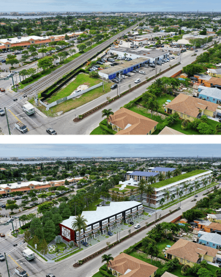
A growing concern among planning professionals is the unintended consequence of APFOs becoming a barrier to housing production, particularly in infill areas and high-demand urban markets, where land is limited. When applied rigidly or informed by incomplete data, APFOs can stifle housing supply by delaying or denying development approvals, even when infrastructure conditions on the ground are acceptable or improving.
In some jurisdictions, schools are flagged as overcapacity based on student-generation projections developed years ago, despite recent enrollment declines or shifting household demographics. In other cases, traffic impacts are modeled using generalized trip-generation rates that fail to account for proximity to public transit, multimodal infrastructure, or trends in reduced vehicle ownership. In such instances, development is halted not because of actual infrastructure shortfalls, but because the metrics used to measure adequacy are misaligned with reality.
Furthermore, the use of uniform LOS standards across diverse development contexts, applying the same traffic thresholds to urban infill projects as to greenfield developments, ignores the lower per-capita infrastructure burden of compact, transit-oriented housing. This inflexibility discourages development in areas where it is most appropriate and efficient, while allowing sprawl to continue in areas less equipped to support it.
This misapplication of APFOs can have far-reaching implications for housing affordability and sustainability. In regions with acute housing shortages, delays in development approval directly translate into lost units, increased costs, and diminished public trust in planning processes.
Hypothetical Scenario: Greenfield Junction
In a rapidly growing suburban community within a major metropolitan region, referred to here as Greenfield Junction, a 300-unit mixed-income housing development was proposed. The site was already zoned for residential use and strategically located near transit and major employment centers. The development plan included 20% affordable-housing units and was fully consistent with the jurisdiction’s comprehensive plan.
Despite meeting local policy objectives, the project was ultimately denied under the APFO, with several factors contributing to the decision. School capacity was cited as insufficient based on decade-old student-generation rates geared to large suburban homes, declaring the elementary school would breach the 110% capacity cap even though current enrollment is falling, and the smaller mixed-income units would yield far fewer students. Transportation impacts evaluated using single-family trip rates overlooked the site’s short walk to a future transit stop and new bike lanes, so they predicted excessive congestion. Additionally, the LOS standards applied were rigid and failed to differentiate between infill development and greenfield expansion, overlooking the typically lower per-unit traffic impact of urban-style housing.
The consequences of the denial were significant. The project was delayed indefinitely, and after 18 months of incurring holding costs, the developer withdrew. As a result, the jurisdiction lost the opportunity to gain 60 affordable units and much-needed transit-oriented housing in a designated growth area. Meanwhile, the continued construction of market-rate homes just outside the APFO boundaries, in locations with weaker infrastructure and no public transit access, undermined broader planning and goals.
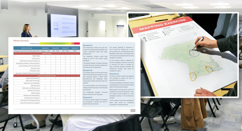
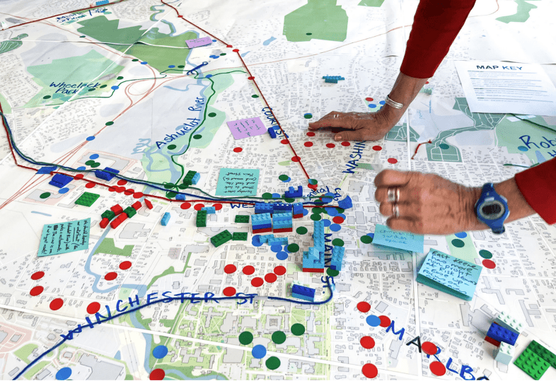
At WGI, we understand planning must evolve alongside the communities it serves. Our Urban & Community Planning team brings expertise in bridging the divide between infrastructure adequacy assessments and housing production goals. We partner with clients to design and implement data systems that transform APFOs from reactive instruments into proactive planning tools.
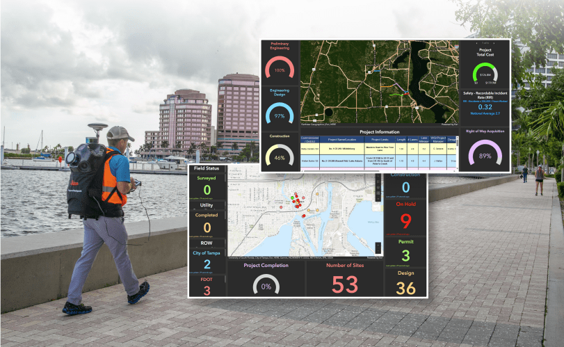
For example, consider a city aiming to modernize its APFO framework. By creating a comprehensive infrastructure-housing database that integrates GIS, utility capacity, and demographic data, the city could visualize infrastructure conditions in real time, simulate the impacts of future housing growth, and calibrate LOS assessments with context-sensitive metrics.
Scenario-based modeling would allow the city to forecast development impacts and align them with its Capital Improvement Program. Real-time dashboards would enhance transparency and public engagement, while refined trip generation rates for transit-accessible areas would ensure impact assessments reflect actual travel behavior. In this type of system, outdated data would no longer be a barrier, making it possible to advance infill and affordable-housing projects that meet both infrastructure adequacy and community housing needs.
Smarter Governance and Policy Reform
Improving APFO outcomes requires more than technical fixes; it demands governance structures and policy reforms that embed data transparency and interagency coordination into planning processes. WGI advocates for the establishment of interagency data governance committees tasked with overseeing infrastructure data standards, updates, and integration across departments.
Regular alignment between APFO updates, housing element updates, and capital improvement planning cycles is essential. Infrastructure capacity maps and LOS dashboards should be publicly accessible and incorporated
into development review processes. Furthermore, jurisdictions should consider adopting phased APFO triggers tied to infrastructure investment milestones, allowing for managed, data-informed flexibility. Policies that incentivize or exempt affordable-housing projects in designated infill areas, when supported by robust data, can ensure that infrastructure adequacy does not become a pretext for housing avoidance.
Planning Smarter Together
Infrastructure adequacy remains a cornerstone of responsible urban planning. However, the tools used to measure and manage such adequacy must keep pace with modern data capabilities, evolving community needs, and the urgency of the housing crisis. APFOs, when informed by accurate, timely, and integrated data systems, can facilitate sustainable growth.
WGI stands at the forefront of this transformation. Our planners and engineers understand the complexities of infrastructure systems, the imperatives of housing production, and the value of data in uniting these priorities. We believe planning is a balancing act between the physical, cultural, historical, and economic forces shaping our communities, and our team has the expertise, creativity, and civic-minded approach needed to manage that balance.
By modernizing APFO systems and reimagining their role in the development process, communities can move beyond outdated constraints and toward a future where infrastructure and housing goals are mutually reinforcing. With the right data and the right partners, this future is within reach.
To learn more about how WGI can support your community’s planning goals, connect with our Urban & Community Planning team today.
Let's Talk.
For more information about this paper or to have a conversation with one of our experts, please contact us today.
.png?width=185&height=175&name=WGI%20Icon_Green%20(1).png)